
Content deleted Content added
Latest revision as of 03:01, 23 January 2026
Aguja Bífida is a mountain in the Magallanes Region of Chile.
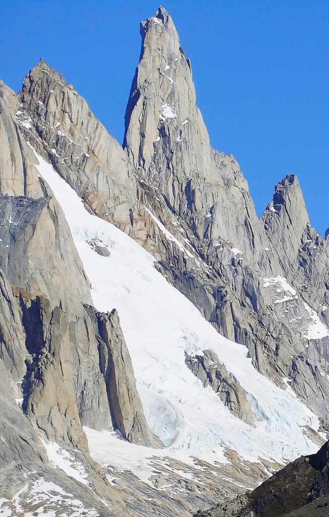
Aguja Bífida is a 2,394-meter-elevation (7,854-foot) summit in the Andes. The peak is located four kilometers (2.5 miles) west of Fitz Roy and 16 kilometers (10 miles) west-northwest of El Chaltén in Patagonia. It is set in Chaltén Mountain Range Natural Site which is part of Bernardo O’Higgins National Park. Topographic relief is significant as the summit rises 1,000 meters (3,280 ft) above the Torre Glacier in one kilometer (0.6 mile). Precipitation runoff from the peak’s slopes drains to Viedma Lake. The first ascent of the lower south summit was made in 1975 by Paul von Känel and Hans Peter Trachsel.[1] Peter Lüthi and Horacio Bresba were the first to successfully climb the higher north summit in 1989 via the north face.[3] The descriptive toponym, which translates as Split Needle, was applied by Louis Lliboutry in 1952.[4][5] The nearest higher peak is Cerro Standhardt, 0.73 kilometer (0.45 mile) to the south.[2]
Established climbing routes with first ascents:
- South Summit – 1975 – Paul von Känel, Hans Peter Trachsel
- North Summit – 1989 – Peter Lüthi, Horacio Bresba
- Hielo y Fuego (West Face) – 1996 – P. Cavagneto, R. Giovanetto, M. Motto, G. Predan, C. Ravaschietto[6]
- Cogan (East Face) – 2007 – Crystal Davis-Robbins, Nico Gutierrez[7]
- Northeast Spur – 2011 – Oriol Baró, Paula Alegre[8]
- The Siren (East Face) – 2016 – Matt Burdekin, Tom Ripley[9]
According to the Köppen climate classification system, Aguja Bífida is located in a tundra climate zone with cold, snowy winters, and cool summers.[10] Weather systems are forced upward by the mountains (orographic lift), causing moisture to drop in the form of rain and snow. This climate supports the Viedma Glacier to the west of the pillar and the Torre Glacier to the east. The months of November through February offer the most favorable weather for visiting or climbing this peak.[11]
- ^ a b Aguja Bífida (2394 m.), Andeshandbook.org, Retrieved January 22, 2026.
- ^ a b c d e “Aguja Bífida”. Peakvisor.com. Retrieved January 22, 2026.
- ^ South America, Patagonia, Aguja dela Silla, East Spur, and Aguja Bifida, North Face, publications.americanalpineclub.org, Vojslav Arko, 1990, Retrieved January 22, 2026.
- ^ Mountain Toponyms., PATAclimb.com, Retrieved January 22, 2026.
- ^ Lliboutry, Louis. Le Massif du Fitz Roy: Carte au 1:50 000. Expédition Française au Fitz Roy, 1953.
- ^ South America, Argentina, Argentine Patagonia, Aguja Bifida, West Face, 1997, publications.americanalpineclub.org, Retrieved January 22, 2026.
- ^ Two “New” Routes in Patagonia, Dougald MacDonald, Climbing Magazine, Retrieved January 22, 2026.
- ^ Oriol Baró y Paula Alegre terminan una vía nueva en la Aguja Bífida, Desnivel.com, Retrieved January 22, 2026.
- ^ Brits Climb New Route in Patagonia, Natalie Berry, ukclimbing.com, Retrieved January 22, 2026.
- ^ Peel, M. C.; Finlayson, B. L.; McMahon, T. A. (2007). “Updated world map of the Köppen-Geiger climate classification” (PDF). Hydrology and Earth System Sciences. 11 (5): 1633–1644. Bibcode:2007HESS…11.1633P. doi:10.5194/hess-11-1633-2007. Archived (PDF) from the original on 2019-12-02. Retrieved 2025-11-07.
- ^ When is the Best Time to Visit Patagonia?, Wildernesstravel.com, Retrieved January 22, 2026.

