
}}
}}
”’Péhunco”’ {{IPA|fr|pe.œ̃ŋ.ko|}} or ”’Péhonko”’ {{IPA|fr|pe.ɔ̃ŋ.ko|}} often referred to as ”Ouassa-Péhunco” is a town, [[Arrondissements of Benin|arrondissement]] and [[Communes of Benin|commune]] located in the [[Atakora Department]] of [[Benin]]. The commune covers an area of approximately 1,900 km² and had a population of 78,217 at the 2013 census. <ref name=”Decent”>« OUASSA-PEHUNCO », Ministry of Decentralisation — Commune profile.</ref><ref name=”INSAE”>INSAE, RGPH-4 (2013) — village/commune data.</ref> <ref name=”Atlasbenin”>{{cite web|url=http://atlasbenin.africa-web.org/Atacora/Pehunco.htm|title=Pehunco|publisher=Atlas Monographique des Communes du Benin|access-date=January 5, 2010|archive-url=https://web.archive.org/web/20090226210745/http://atlasbenin.africa-web.org/Atacora/Pehunco.htm|archive-date=February 26, 2009|url-status=dead}}</ref><ref>{{cite web|url=http://www.statoids.com/ybj.html|title=Communes of Benin|publisher=Statoids|access-date=January 5, 2010}}</ref>
”’Péhunco”’ {{IPA|fr|pe.œ̃ŋ.ko|}} or ”’Péhonko”’ {{IPA|fr|pe.ɔ̃ŋ.ko|}} often referred to as ”Ouassa-Péhunco” is a town, [[Arrondissements of Benin|arrondissement]] and [[Communes of Benin|commune]] located in the [[Atakora Department]] of [[Benin]]. The commune covers an area of approximately 1,900 km² and had a population of 78,217 at the 2013 census.<ref name=”Decent”>« OUASSA-PEHUNCO », Ministry of Decentralisation — Commune profile.</ref><ref name=”INSAE”>INSAE, RGPH-4 (2013) — village/commune data.</ref><ref name=”Atlasbenin”>{{cite web|url=http://atlasbenin.africa-web.org/Atacora/Pehunco.htm|title=Pehunco|publisher=Atlas Monographique des Communes du Benin|access-date=January 5, 2010|archive-url=https://web.archive.org/web/20090226210745/http://atlasbenin.africa-web.org/Atacora/Pehunco.htm|archive-date=February 26, 2009|url-status=dead}}</ref><ref>{{cite web|url=http://www.statoids.com/ybj.html|title=Communes of Benin|publisher=Statoids|access-date=January 5, 2010}}</ref>
== Geography ==
== Geography ==
Péhunco lies in the western part of the Atakora Department, on a peneplain located between the valleys of the Alibori river to the east and the Mékrou to the west. The commune is traversed by seasonal streams and rivers and benefits from a Sudanian (soudano-guinean) climate with a long rainy season (roughly May–October). Elevations are modest and the landscape alternates wooded savanna, gallery forests and cultivated lowlands. <ref name=”Decent”/><ref name=”Monogr”>Monographie départementale / Atacora (state publication).</ref>
Péhunco lies in the western part of the Atakora Department, on a peneplain located between the valleys of the Alibori river to the east and the Mékrou to the west. The commune is traversed by seasonal streams and rivers and benefits from a Sudanian (soudano-guinean) climate with a long rainy season (roughly May–October). Elevations are modest and the landscape alternates wooded savanna, gallery forests and cultivated lowlands.<ref name=”Decent”/><ref name=”Monogr”>Monographie départementale / Atacora (state publication).</ref>
== Administration ==
== Administration ==
The commune (often styled Ouassa-Péhunco in official documents) is subdivided administratively into three arrondissements: Gnémasson, Péhunco and Tobré. These arrondissements include a number of villages and quarters (see RGPH-4 village list for full breakdown). <ref name=”Decent”/><ref name=”INSAE”/> Péhunco has historically participated in intercommunal cooperation with neighbouring communes (for example within local groupings such as the Communauté des 2KP including Kérou and Kouandé). <ref name=”Monogr”/>
The commune (often styled Ouassa-Péhunco in official documents) is subdivided administratively into three arrondissements: Gnémasson, Péhunco and Tobré. These arrondissements include a number of villages and quarters (see RGPH-4 village list for full breakdown).<ref name=”Decent”/><ref name=”INSAE”/> Péhunco has historically participated in intercommunal cooperation with neighbouring communes (for example within local groupings such as the Communauté des 2KP including Kérou and Kouandé).<ref name=”Monogr”/>
== Population ==
== Population ==
According to the fourth national census (RGPH-4, 2013) the total commune population was 78,217. Population density is approximately 41 inhabitants per km² (2013 data). Ethnic composition includes a majority of Bariba (Baatombu) and other local groups; the Peul (Fulɓe) are present and constitute a notable pastoral community; smaller minorities include Dendi, Lokpa and others. Languages used locally include French (official), Baatɔnum (Bariba) and local lingua francas. Religious practice is mixed (Islam, traditional religions, Christianity). <ref name=”INSAE”/><ref name=”Decent”/>
According to the fourth national census (RGPH-4, 2013) the total commune population was 78,217. Population density is approximately 41 inhabitants per km² (2013 data). Ethnic composition includes a majority of Bariba (Baatombu) and other local groups; the Peul (Fulɓe) are present and constitute a notable pastoral community; smaller minorities include Dendi, Lokpa and others. Languages used locally include French (official), Baatɔnum (Bariba) and local lingua francas. Religious practice is mixed (Islam, traditional religions, Christianity).<ref name=”INSAE”/><ref name=”Decent”/>
== History ==
== History ==
Local oral histories and administrative sources state that the settlement grew from Bariba hunting and settlement groups in the 18th century; the place name and some ritual sites (e.g. “pierre noire” / black stone) are referenced in regional monographs. Péhunco’s modern administrative identity has been shaped by Benin’s decentralisation reforms (post-1990s) and the creation of communes with elected councils. <ref name=”Decent”/><ref name=”Monogr”/>
Local oral histories and administrative sources state that the settlement grew from Bariba hunting and settlement groups in the 18th century; the place name and some ritual sites (e.g. “pierre noire” / black stone) are referenced in regional monographs. Péhunco’s modern administrative identity has been shaped by Benin’s decentralisation reforms (post-1990s) and the creation of communes with elected councils.<ref name=”Decent”/><ref name=”Monogr”/>
== Economy ==
== Economy ==
Agriculture (rainfed cereals, cotton, market gardening in lowlands) and livestock rearing (cattle, goats, sheep, poultry) form the backbone of the local economy. Food crops include sorghum, millet, maize, yams and rice in suitable lowlands; cotton is an important cash crop in some areas. Small-scale trading, artisanal activities and seasonal migration for work supplement incomes. <ref name=”Monogr”/><ref name=”PlanPD”>Local development plans (commune / departmental documents).</ref>
Agriculture (rainfed cereals, cotton, market gardening in lowlands) and livestock rearing (cattle, goats, sheep, poultry) form the backbone of the local economy. Food crops include sorghum, millet, maize, yams and rice in suitable lowlands; cotton is an important cash crop in some areas. Small-scale trading, artisanal activities and seasonal migration for work supplement incomes.<ref name=”Monogr”/><ref name=”PlanPD”>Local development plans (commune / departmental documents).</ref>
== Infrastructure and services ==
== Infrastructure and services ==
[[File:Péhunco – Cour de l’école primaire.jpg|Péhunco – Cour de l’école primaire|399x399px]]
[[File:Péhunco – Cour de l’école primaire.jpg|Péhunco – Cour de l’école primaire|399x399px]]
=== Transport ===
=== Transport ===
Road access is primarily by rural and departmental roads connecting the town to neighbouring communes (Kérou, Kouandé, Natitingou). Seasonal variations can affect accessibility during heavy rains. <ref name=”IGL”>IGL / decentralisation indicators (communal infrastructure dossiers).</ref>
Road access is primarily by rural and departmental roads connecting the town to neighbouring communes (Kérou, Kouandé, Natitingou). Seasonal variations can affect accessibility during heavy rains.<ref name=”IGL”>IGL / decentralisation indicators (communal infrastructure dossiers).</ref>
=== Water and energy ===
=== Water and energy ===
Water supply relies on boreholes, wells and small water towers in some communities; electrification remains limited outside the main town, though rural electrification projects and small solar installations have been reported in the Atacora region. <ref name=”Decent”/>
Water supply relies on boreholes, wells and small water towers in some communities; electrification remains limited outside the main town, though rural electrification projects and small solar installations have been reported in the Atacora region.<ref name=”Decent”/>
=== Education and health ===
=== Education and health ===
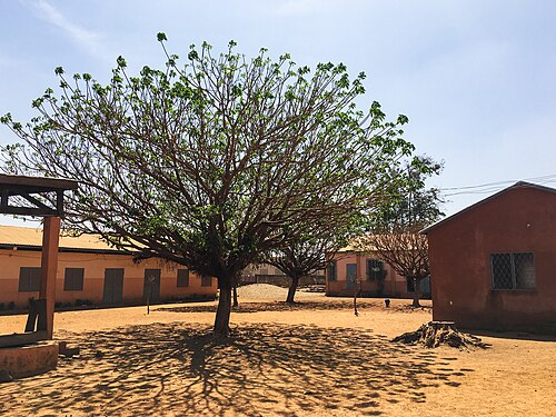
Péhunco hosts basic education facilities (primary schools and at least one secondary level institution) and basic health centres; service coverage and quality are typical of remote rural communes in northern Benin and are targets of regional development programmes. <ref name=”Monogr”/><ref name=”INSAE”/>
Péhunco hosts basic education facilities (primary schools and at least one secondary level institution) and basic health centres; service coverage and quality are typical of remote rural communes in northern Benin and are targets of regional development programmes.<ref name=”Monogr”/><ref name=”INSAE”/>
== Culture and heritage ==
== Culture and heritage ==
[[File:Péhunco – Un plat de Ablo.jpg|Péhunco – Un plat de Ablo|border|267x267px]]
[[File:Péhunco – Un plat de Ablo.jpg|Péhunco – Un plat de Ablo|border|267x267px]]
The commune is locally known as the “cité des pierres noires” in reference to a traditional sacred stone and related ritual heritage. Cultural life is structured around Bariba traditions, seasonal festivals, markets and local craftwork. <ref name=”Decent”/>
The commune is locally known as the “cité des pierres noires” in reference to a traditional sacred stone and related ritual heritage. Cultural life is structured around Bariba traditions, seasonal festivals, markets and local craftwork.<ref name=”Decent”/>
== Governance ==
== Governance ==
The commune is administered by a mayor and municipal council (conseil communal). The current mayor (as listed by the Ministry of Decentralisation and reported in local press) is Orou Maré Koto (elected following the 2020 municipal elections). <ref name=”Decent”/> <ref name=”Press”>Local press reports and municipal communications (e.g. Daabaaru, Le Matinal) reporting mayoral activity and statements.</ref>
The commune is administered by a mayor and municipal council (conseil communal). The current mayor (as listed by the Ministry of Decentralisation and reported in local press) is Orou Maré Koto (elected following the 2020 municipal elections).<ref name=”Decent”/><ref name=”Press”>Local press reports and municipal communications (e.g. Daabaaru, Le Matinal) reporting mayoral activity and statements.</ref>
== Security and development challenges ==
== Security and development challenges ==
Like other border communes in northern Benin, Péhunco faces development challenges including limited infrastructure, seasonal access problems, healthcare and education gaps, and pressures on pastoralist systems. Local development plans and departmental programmes identify road rehabilitation, water access, and agricultural value-chain support as priorities. <ref name=”PlanPD”/><ref name=”IGL”/>
Like other border communes in northern Benin, Péhunco faces development challenges including limited infrastructure, seasonal access problems, healthcare and education gaps, and pressures on pastoralist systems. Local development plans and departmental programmes identify road rehabilitation, water access, and agricultural value-chain support as priorities.<ref name=”PlanPD”/><ref name=”IGL”/>
==References==
==References==
Place in Atakora Department, Benin
Péhunco [pe.œ̃ŋ.ko] or Péhonko [pe.ɔ̃ŋ.ko] often referred to as Ouassa-Péhunco is a town, arrondissement and commune located in the Atakora Department of Benin. The commune covers an area of approximately 1,900 km² and had a population of 78,217 at the 2013 census.[1][2][3][4]
Péhunco lies in the western part of the Atakora Department, on a peneplain located between the valleys of the Alibori river to the east and the Mékrou to the west. The commune is traversed by seasonal streams and rivers and benefits from a Sudanian (soudano-guinean) climate with a long rainy season (roughly May–October). Elevations are modest and the landscape alternates wooded savanna, gallery forests and cultivated lowlands.[1][5]
The commune (often styled Ouassa-Péhunco in official documents) is subdivided administratively into three arrondissements: Gnémasson, Péhunco and Tobré. These arrondissements include a number of villages and quarters (see RGPH-4 village list for full breakdown).[1][2] Péhunco has historically participated in intercommunal cooperation with neighbouring communes (for example within local groupings such as the Communauté des 2KP including Kérou and Kouandé).[5]
According to the fourth national census (RGPH-4, 2013) the total commune population was 78,217. Population density is approximately 41 inhabitants per km² (2013 data). Ethnic composition includes a majority of Bariba (Baatombu) and other local groups; the Peul (Fulɓe) are present and constitute a notable pastoral community; smaller minorities include Dendi, Lokpa and others. Languages used locally include French (official), Baatɔnum (Bariba) and local lingua francas. Religious practice is mixed (Islam, traditional religions, Christianity).[2][1]
Local oral histories and administrative sources state that the settlement grew from Bariba hunting and settlement groups in the 18th century; the place name and some ritual sites (e.g. “pierre noire” / black stone) are referenced in regional monographs. Péhunco’s modern administrative identity has been shaped by Benin’s decentralisation reforms (post-1990s) and the creation of communes with elected councils.[1][5]
Agriculture (rainfed cereals, cotton, market gardening in lowlands) and livestock rearing (cattle, goats, sheep, poultry) form the backbone of the local economy. Food crops include sorghum, millet, maize, yams and rice in suitable lowlands; cotton is an important cash crop in some areas. Small-scale trading, artisanal activities and seasonal migration for work supplement incomes.[5][6]
Infrastructure and services
[edit]

Road access is primarily by rural and departmental roads connecting the town to neighbouring communes (Kérou, Kouandé, Natitingou). Seasonal variations can affect accessibility during heavy rains.[7]
Water supply relies on boreholes, wells and small water towers in some communities; electrification remains limited outside the main town, though rural electrification projects and small solar installations have been reported in the Atacora region.[1]
Education and health
[edit]
Péhunco hosts basic education facilities (primary schools and at least one secondary level institution) and basic health centres; service coverage and quality are typical of remote rural communes in northern Benin and are targets of regional development programmes.[5][2]
Culture and heritage
[edit]

The commune is locally known as the “cité des pierres noires” in reference to a traditional sacred stone and related ritual heritage. Cultural life is structured around Bariba traditions, seasonal festivals, markets and local craftwork.[1]
The commune is administered by a mayor and municipal council (conseil communal). The current mayor (as listed by the Ministry of Decentralisation and reported in local press) is Orou Maré Koto (elected following the 2020 municipal elections).[1][8]
Security and development challenges
[edit]
Like other border communes in northern Benin, Péhunco faces development challenges including limited infrastructure, seasonal access problems, healthcare and education gaps, and pressures on pastoralist systems. Local development plans and departmental programmes identify road rehabilitation, water access, and agricultural value-chain support as priorities.[6][7]
- ^ a b c d e f g h « OUASSA-PEHUNCO », Ministry of Decentralisation — Commune profile.
- ^ a b c d INSAE, RGPH-4 (2013) — village/commune data.
- ^ “Pehunco”. Atlas Monographique des Communes du Benin. Archived from the original on February 26, 2009. Retrieved January 5, 2010.
- ^ “Communes of Benin”. Statoids. Retrieved January 5, 2010.
- ^ a b c d e Monographie départementale / Atacora (state publication).
- ^ a b Local development plans (commune / departmental documents).
- ^ a b IGL / decentralisation indicators (communal infrastructure dossiers).
- ^ Local press reports and municipal communications (e.g. Daabaaru, Le Matinal) reporting mayoral activity and statements.

