
<ref name=ew>Barbara Petrozolin-Skowrońska (editor): ”Encyklopedia Warszawy”. Warsaw: Wydawnictwo Naukowe PWN, 1994. ISBN 83-01-08836-2.</ref><ref name=chmiel>Lech Chmielewski: ”Przewodnik warszawski. Gawęda o nowej Warszawie”. Warsaw: Agencja Omnipress, Państwowe Przedsiębiorstwo Wydawnicze Rzeczpospolita. ISBN 8385028560. (in Polish)</ref><ref name=atlas>Andrzej Rottermund, Juliusz Chrościcki: ”Atlas architektury Warszawy”. Warsaw: Arkady. ISBN 8301088362. (in Polish)</ref> It also included a small park, later named Marek Kotański Park.<ref name=park1>{{cite web|url=https://wlochy.um.warszawa.pl/-/park-im-marka-kotanskiego|website=wlochy.um.warszawa.pl|title=Park im. Marka Kotańskiego|language=pl}}</ref><ref name=park2>Weseła Wojnarowicz, Paweł Gnieszawa-Słodkowski: ”[https://web.archive.org/web/20180624154134/http://www.ud-wlochy.waw.pl/data/dataPublicator/ksiazka_parki_03_12_net.pdf Dzielnica Włochy. Parki, zieleńce, zabytki…]”. Warsaw: Włochy Municipal Office. 2012. p. 8. ISBN 978-83-928365-4-4. (in Polish)</ref>
<ref name=ew>Barbara Petrozolin-Skowrońska (editor): ”Encyklopedia Warszawy”. Warsaw: Wydawnictwo Naukowe PWN, 1994. ISBN 83-01-08836-2.</ref><ref name=chmiel>Lech Chmielewski: ”Przewodnik warszawski. Gawęda o nowej Warszawie”. Warsaw: Agencja Omnipress, Państwowe Przedsiębiorstwo Wydawnicze Rzeczpospolita. ISBN 8385028560. (in Polish)</ref><ref name=atlas>Andrzej Rottermund, Juliusz Chrościcki: ”Atlas architektury Warszawy”. Warsaw: Arkady. ISBN 8301088362. (in Polish)</ref> It also included a small park, later named Marek Kotański Park.<ref name=park1>{{cite web|url=https://wlochy.um.warszawa.pl/-/park-im-marka-kotanskiego|website=wlochy.um.warszawa.pl|title=Park im. Marka Kotańskiego|language=pl}}</ref><ref name=park2>Weseła Wojnarowicz, Paweł Gnieszawa-Słodkowski: ”[https://web.archive.org/web/20180624154134/http://www.ud-wlochy.waw.pl/data/dataPublicator/ksiazka_parki_03_12_net.pdf Dzielnica Włochy. Parki, zieleńce, zabytki…]”. Warsaw: Włochy Municipal Office. 2012. p. 8. ISBN 978-83-928365-4-4. (in Polish)</ref>
The Warsaw Chopin Airport was expanded between 1962 and 1969, including the construction of a new main runway and taxiways, an international transport hub, and an air traffic control tower, passenger hall, and technical-administrative and goods-postal infrastructure.<ref name=krzyz>Krystyna Krzyżakowa: “Warszawskie osiągnięcia” [in:] ”Kalendarz Warszawski ’88”. Warsaw: Krajowa Agencja Wydawnicza, 1987, p. 148–149. ISBN 83-03-01684-9. (in Polish)</ref><ref>Bronisław Dostatni: “Ochota ośrodkiem komunikacji lotniczej”, [in:] ”Dzieje Ochoty”. Warsaw: Państwowe Wydawnictwo Naukowe, 1973, p. 189. (in Polish)</ref><ref>Barbara Petrozolin-Skowrońska (editor): ”Encyklopedia Warszawy”. Warsaw: Państwowe Wydawnictwo Naukowe, 1975, p. 84. (in Polish)</ref> The new domestic transport hub was opened in 1975, and a new [[airport terminal|terminal]] for arriving passengers was opened in 1978.<ref name=krzyz/><ref>{{cite web|url=https://www.lotnisko-chopina.pl/pl/historia.html|website=lotnisko-chopina.pl|language=pl|title=Nasza historia}}</ref> In 1980, the runways were extended and modernised.<ref name=krzyz/>
The Warsaw Chopin Airport was expanded between 1962 and 1969, including the construction of a new main runway and taxiways, an international transport hub, and an air traffic control tower, passenger hall, and technical-administrative and goods-postal infrastructure.<ref name=krzyz>Krystyna Krzyżakowa: “Warszawskie osiągnięcia” [in:] ”Kalendarz Warszawski ’88”. Warsaw: Krajowa Agencja Wydawnicza, 1987, p. 148–149. ISBN 83-03-01684-9. (in Polish)</ref><ref>Bronisław Dostatni: “Ochota ośrodkiem komunikacji lotniczej”, [in:] ”Dzieje Ochoty”. Warsaw: Państwowe Wydawnictwo Naukowe, 1973, p. 189. (in Polish)</ref><ref>Barbara Petrozolin-Skowrońska (editor): ”Encyklopedia Warszawy”. Warsaw: Państwowe Wydawnictwo Naukowe, 1975, p. 84. (in Polish)</ref> The new domestic transport hub was opened in 1975, and a new [[airport terminal|terminal]] for arriving passengers was opened in 1978.<ref name=krzyz/><ref>{{cite web|url=https://www.lotnisko-chopina.pl/pl/historia.html|website=lotnisko-chopina.pl|language=pl|title=Nasza historia}}</ref> In 1980, the runways were extended and modernised.<ref name=krzyz/>
On 19 December 1962, a [[Vickers Viscount]] turboprop airliner operated by LOT Polish Airlines on a flight from [[Brussels]] to Warsaw, [[1962 LOT Vickers Viscount Warsaw crash|crashed on landing]] at the Warsaw Chopin Airport, with al of l33 passengers and crew dying in the accident.<ref name=”DB1962-12-21″>{{cite journal |date=21 December 1962 |title=Po tragicznej katastrofie “Viscounta” na Okęciu: Ustalono już listę ofiar katastrofy |trans-title=After the tragic crash of “Viscount” at Okęcie: The list of victims of the disaster has already been established |url=http://bibliotekacyfrowa.eu/dlibra/doccontent?id=23333 |journal=[[Dziennik Bałtycki]] |language=pl |location=Gdańsk |volume=XVIII |issue=302 |access-date=9 May 2013}}</ref> Another major aviation accident in Okęcie took place on 14 March 1980, when a [[Ilyushin Il-62]] jetliner crashed [[LOT Polish Airlines Flight 007|crashed]] next to the airport and Fort Vi, after aborting a landing and attempting to [[go-around]]. It was operated on a flight from [[New York City]] to Warsaw. All of its 87 passengers and crew died in the accident. It was caused by the disintegration of a turbine disc in one of the plane’s engines, leading to uncontained engine failure.<ref>{{cite web|url=https://dlapilota.pl/wiadomosci/piotr-karwinski/35-rocznica-katastrofy-il-62-mikolaj-kopernik|website=dlapilota.pl|language=pl|title=45 rocznica katastrofy Ił-a 62 ‘Mikołaj Kopernik’|date=14 March 2025}}</ref><ref>Tomasz Smolicz: ”Lima, Oskar…”. Kraków–Wrocław: Wydawnictwo Literackie, 1985, pp. 132–138. ISBN 83-08-01407-0. (in Polish)</ref><ref>Dariusz Burliński: ”Katastrofy lotnicze. Tajemnice wypadków polskich samolotów”. Warsaw: Ringier Axel Springer, 2014, pp. 42–55. ISBN 978-83-7813-624-8. (in Polish)</ref>
On 19 December 1962, a [[Vickers Viscount]] turboprop airliner operated by LOT Polish Airlines on a flight from [[Brussels]] to Warsaw, [[1962 LOT Vickers Viscount Warsaw crash|crashed on landing]] at the Warsaw Chopin Airport, with al of l33 passengers and crew dying in the accident.<ref name=”DB1962-12-21″>{{cite journal |date=21 December 1962 |title=Po tragicznej katastrofie “Viscounta” na Okęciu: Ustalono już listę ofiar katastrofy |trans-title=After the tragic crash of “Viscount” at Okęcie: The list of victims of the disaster has already been established |url=http://bibliotekacyfrowa.eu/dlibra/doccontent?id=23333 |journal=[[Dziennik Bałtycki]] |language=pl |location=Gdańsk |volume=XVIII |issue=302 |access-date=9 May 2013}}</ref> Another major aviation accident in Okęcie took place on 14 March 1980, when a [[Ilyushin Il-62]] jetliner crashed [[LOT Polish Airlines Flight 007|crashed]] next to the airport and Fort Vi, after aborting a landing and attempting to [[go-around]]. It was operated on a flight from [[New York City]] to Warsaw. All of its 87 passengers and crew died in the accident. It was caused by the disintegration of a turbine disc in one of the plane’s engines, leading to uncontained engine failure.<ref>{{cite web|url=https://dlapilota.pl/wiadomosci/piotr-karwinski/35-rocznica-katastrofy-il-62-mikolaj-kopernik|website=dlapilota.pl|language=pl|title=45 rocznica katastrofy Ił-a 62 ‘Mikołaj Kopernik’|date=14 March 2025}}</ref><ref>Tomasz Smolicz: ”Lima, Oskar…”. Kraków–Wrocław: Wydawnictwo Literackie, 1985, pp. 132–138. ISBN 83-08-01407-0. (in Polish)</ref><ref>Dariusz Burliński: ”Katastrofy lotnicze. Tajemnice wypadków polskich samolotów”. Warsaw: Ringier Axel Springer, 2014, pp. 42–55. ISBN 978-83-7813-624-8. (in Polish)</ref>
Neighbourhood of Warsaw, Poland
Okęcie (Polish: [ɔˈkɛɲ.t͡ɕɛ]) is a neighbourhood, and a City Information System area, in Warsaw, Poland, within the Włochy district.

In 1232, the village of Raków was first recorded in the area, when it was given to knight Gotard of Służew, by Duke Konrad I of Masovia, the ruler of the Duchy of Masovia. In the 14th century, the village of Okęcie was separated from the southeastern part of Raków, being first attested in records in 1421.[1][2][3] They were owned by the Rakowiecki family, which descended from Gotard of Służew, and was part of the Radwan clan. In the 16th century, the branch owning Okęcie adopted the name Okęcki.[1][2] In 1409, two more villages, Gorzkiewki and Zbarż, are recorded to be present to the southeast of Okęcie, owned by the Zbarski family.[1][4] In 1447, Raków was granted the Kulm law rights by Duke Bolesław IV of Warsaw, the ruler of the Duchy of Masovia, with Gorzkiewki and Zbarż also receiving them in 1451.[1][2][4]
In 1528, the farmlands of Raków and Okęcie measured 6 and 2 lans, which corresponded to around 108 and 36 hectares, respectively.[1][2] The same year, Zbarż was acquired by the Babicki family. In 1652, Okęcie was bought by Paweł Petrykowski, the parson of Drohiczyn and archdeacon of Pułtusk. Following which, the hamlet of Paluch was founded between Okęcie and Gorzkiewki.[1][5] The same century, Raków was acquired by magnate and politician Stanisław Warszycki, while Zbarż, by Rozrażewski, the voivode of Inowrocław Voivodeship, who also owned Gorzkiewki and Służew.[1][4][2] The area changed hands over the next centuries, including being owned by Lubomirski, and Plater families, among others.[1][2] In the 18th century, Paluch was acquired by Arnold Anastazy Byszewski, the lieutenant general of the Crown Army, and the aide-de-camp of King Stanisław August Poniatowski. In the 19th century, Okęcie and Raków were incorporated into the Łabęcki family’s landed estate, with new buildings being constructed alongside modern Komitetu Obrony Robotników Street. In 1827, Raków had 185 residents, making it the second largest settlement in the area, after Solipse.[6] In 1856, a palace residence was built in Okęcie, for the Bagniewski family, and was demolished in the next century.[5][6] Following the abolition of serfdom in 1864, the area was incorporated into the municipality of Skorosze.[7] In 1883, Forts VI “Okęcie” and VII “Zbarż” were constructed by the Imperial Russian Army near Raków and Okęcie, as part of the city fortifications, known as the Warsaw Fortress.[8][9] As such, the government heavily restricted construction in their vicinity, hindering the development of the nearby villages. Around that time, Kraków Road (now forming Krakowska Avenue) was built next to the village, connecting Warsaw and Kraków.[2][8] At the beginning of the 20th century, Raków had 21 households. The village was eventually surpassed in size by the rapidly developing Okęcie, and was subsequently incorporated into it in the late 1920s.[10][8] The military fortifications were retired and partially demolished in 1913.[9] In 1929, the Okęcie Warsaw association football club was founded in Okęcie, with the homefield located at 1 Radarowa Street since 1963.[11][12][13]
Between the 1920s and 1930s, the course of the Sadurka stream, which flowed through Okęcie, was artificially altered to bypass the area.[14][15]

In 1923, tram tracks were constructed alongside Kraków Road, connecting Okęcie with Warsaw.[10] In 1925, the government acquired 285 ha of land from Okęcie, Paluch, and Gorzkiewki, for the development of the Warsaw Chopin Airport, known until 2001 as the Warsaw Okęcie Airport, and another 200 ha for the nearby infrastructure.[16][17][18] Its construction began in 1933, and it was opened on 29 April 1934, becoming the largest airport in Poland.[19][20] It included two dirt intersecting runways, measuring 1,470 and 1,270 m (4,822.84 and 4,166.67 ft).[18] It was originally only planned as a military airbase. However, upon its opening, it also replaced Mokotów Aerodrome as a passenger and cargo airport. It also became the headquarters of the LOT Polish Airlines, and the home base of the 1st Aviation Regiment of the Polish Armed Forces.[21][22] Around the airport were also developed factories catered to the aviation industry, such as Doświadczalne Warsztaty Lotnicze (Experimental Aeronautical Workshops) and Państwowe Zakłady Lotnicze (State Aviation Works), and research institutions, such as the Institute of Aviation.[18][20] Additionally, in 1932, a weather station was also opened next to the airport.[23] Additionally, numerous factories began developing in Okęcie and Raków throughout the 1920s and 1930s.[2][5][18] In 1934, Żwirki i Wigury Street was opened, providing a direct connection between the airport and the Downtown Warsaw.[24][25] In 1935, a 20-metre-tall steel column, topped with a sculpture of three eagles, was unveiled at the airport. It was dedicated to Józef Piłsudski, a 20th-century statesman who served as the Chief of State from 1918 to 1922, and the Marshal of Poland from 1920 to 1935. The monument was destroyed in 1944.[26][27] On 1 April 1939, Okęcie became the seat of a new municipality, named after it, which encompassed the surrounding area.[28] In 1934, the Warszawa Okęcie railway station was opened near the airport. It formed a connection with the Warszawa Aleje Jerozolimskie station near Jerusalem Avenue, predominantly used by cargo trains.[29][30] The line passed through Okęcie, including stations Wyczółki and Lotnisko, and was closed down in 1966, except its terminal stations.[30] Additionally, between 1937 and 1939, a railway line operated between stations in Wyczółki and Paluch, with a stop at the factories of Państwowe Zakłady Lotnicze.[31][32]
The airport was bombed on 1 September 1939 by the German Air Force, during the first hours of the German invasion of Poland, which began the Second World War. It was captured on 8 September, and following repairs, it began to be used by the German Air Force.[20] On 12 September, a group of soldiers from the 360th Infantry Regiment of the Polish Armed Forces, led by lieutenant colonel Jakub Chmura, together with two tank companies, attacked German positions in Okęcie. It aimed to identify enemy forces on the western outskirts of Warsaw, liquidate German defences and take prisoners.[33][34] Its right wing captured Fort M, while the left wing headed towards Służewiec and Fort VI, while the main group advanced towards the airport.[33] The attack was planned to begin at 3:00 am. However, due to delays with troops arriving at their position, it began at 7:00 am in daylight. Perhaps fearing that, due to the delay, colonel Marian Porwit would call off the attack, Chmura did not give the expected signal, according to which the 2nd Battalion of the 41st Infantry Regiment was to carry out a diversive attack from Ochota, and the heavy artillery was to support the attack on Okęcie.[33] The, unit was divided into three groups. The left wing, commanded by Czesław Chamerski, and supported by half of a tank battalion, captured the Służewiec Racecourse with light German resistance. Then it headed to the Fort VI “Okęcie”, being pushed back by heavy fire from fortified German soldiers, eventually retreating at 11:00 am. The Polish side suffered around 80 dead and wounded soldiers, which was around of its 45% forces.[33][34][35] The right wing, commanded by Leon Radzikowski and Mieczysław Bułatowicz, headed to Fort M alongside Racławicka Street, where they found a Polish Infantry platoon, which was cut of from communications for three days. Further advance was halted due to enemy fire from Żwirki i Wigury Street. In response, they opened fire from their positions at Racławicka Street, and were eventually ordered to retreat in the evening. The main forces, consisting of two infantry companies and a group of tanks, led by Chmura, captured Zbarż and the airport, pushing back light German resistance.[33][35] They continued the attack towards Załuski, however, while crossing an empty field, they were fired from both the west and the south, suffering heavy losses, including their commander, Chmura. Around 11:00 am, the Polish forces retreated. In total, all three groups suffered around 280 soldiers being killed, captured, or wounded, and lost 7 tanks.[33][34][35] On the same day, the German officers committed their first mass murder against the population of Warsaw. In the early morning hours, a Wehrmacht officer (likely a major) was killed on the Kraków Road. According to one version, he was shot dead by a local, while according to another, the car the officer was travelling in was mistakenly shot down by a German aircraft. After this incident, Wehrmacht soldiers conducted a roundup in Okęcie, capturing several dozen men in nearby houses, taking them to the courtyard of the factory of Polskie Zakłady Lotnicze, where they were executed. At least 25 people were killed, of whom 11 were identified. One person survived, being mistaken for dead.[33][34] On 5 October 1939, Adolf Hitler, the dictator of Germany, arrived by plane at the airport to receive the victory parade in Warsaw.[36]
During the occupation, the airport was used for cargo transportation, and a new concrete runway was constructed there. A portion of the 1st division of the Air Fleet 6 of the German Air Force, was stationed at the airport, equipped with Junkers Ju 87 dive bomber aircraft.[20] In 1944, the airport also had 56 anti-aircraft guns.[37] Additionally, during the occupation, the nearby factories in Okęcie and Raków used forced labour from prisoners of war and Jewish civilians.[20] In 1943, Okęcie had a population of 10,699 people, while Zbarż and Gorzkiewki had 237 and 136 residents respectively.[38] On 1 August 1939, at 17:00, codenamed as the W-Hour, a small company of the 7th Infantry Regiment of the Home Army, led by Romuald Jakubowski, attacked the airport. The plans to attack were cancelled an hour prior to the event; however, the group did not receive the new orders in time. The soldiers charged from Zbarż, advancing across an open field, where they came under fierce German machine-gun fire, with Jakubowski dying in the attack. The group was ordered to retreat. However, a German armoured car drove to cut them off, firing at the retreating soldiers. Of the 180 attackers, approximately 120 were killed. The survivors scattered, with a small number successfully travelling to Mokotów.[39][40][41] In October 1944, shortly before retreating from the city, German officers damaged the runway and taxiways and destroyed the air traffic control tower.[20][42] The airport was opened for civilian use in March 1945.[43]
In 1939, the Okęcie Cemetery was created next to Fort VI, as a burial place for the Polish soldiers fallen during the invasion of Poland, and later in 1944, also those fallen in the Warsaw Uprising. The cemetery was closed down in 1956, and the bodies were exhumated and moved to the Powązki Military Cemetery.[44]
On 15 May 1951, it was incorporated into the city of Warsaw.[45][46] Between 1952 and 1961, the housing estate of Okęcie Lotnisko was developed between Hynka, Żwirki i Wigury, Komitetu Obrony Robotników, and Astronautów Streets, on an area of 12,3 ha. Designed for 6,000 residents, it consisted of multiple 4-storey-tall apartment buildings, constructed using the large panel system technique. The neighbourhood was originally envisioned to house workers of the nearby airport and the aviation industry.[47][48] Additionally, between 1952 and 1953, three apartment buildings were constructed at the corner of Flia and Łopuszańska Streets, forming the neighbourhood of Okęcie II. Currently, it is located within the boundaries of the City Information System area of Raków.[49][50] Between 1962 and 1972, another housing estate of apartment buildings was developed between Pierwszego Sierpnia Street, Sulmierzycka Street, Lechicka Street, and Krakowska Avenue. Originally named Okęcie-Pola, it was later renamed to Jadwisin. It was developed for around 6,800, with its buildings being built using the large panel system technique. The neighbourhood was further expanded throughout the 1970s and 1980s, with new buildings constructed alongside Pierwszego Sierpnia Street.
[51][52][53] It also included a small park, later named Marek Kotański Park.[54][55]
The Warsaw Chopin Airport was expanded between 1962 and 1969, including the construction of a new main runway and taxiways, an international transport hub, and an air traffic control tower, passenger hall, and technical-administrative and goods-postal infrastructure.Cite error: A <ref> tag is missing the closing </ref> (see the help page).[56] The new domestic transport hub was opened in 1975, and a new terminal for arriving passengers was opened in 1978.[57][58] In 1980, the runways were extended and modernised.[57]
On 19 December 1962, a Vickers Viscount turboprop airliner operated by LOT Polish Airlines on a flight from Brussels to Warsaw, crashed on landing at the Warsaw Chopin Airport, with al of l33 passengers and crew dying in the accident.[59] Another major aviation accident in Okęcie took place on 14 March 1980, when a Ilyushin Il-62 jetliner crashed crashed next to the airport and Fort Vi, after aborting a landing and attempting to go-around. It was operated on a flight from New York City to Warsaw. All of its 87 passengers and crew died in the accident. It was caused by the disintegration of a turbine disc in one of the plane’s engines, leading to uncontained engine failure.[60][61][62]
In 1962, two railway stations were opened on a line between Warszawa Aleje Jerozolimskie and Warszawa Okęcie, including Warszawa Służewiec at Logarytmiczna Street, and Warszawa Rakowiec at Grójecka Street. They formed part of the railway line between Warsaw West and Kraków Main.[63][64] In 2008, the Warszawa Żwirki i Wigury was opened as part of the line, betweenthe aforementioned stations, and located near Żwirki and Wigury Street.[65] In 2012, the Warsaw Chopin Airport railway station was opened in the airport complex.[66]
Between 1979 and 1987, the Catholic Church of Our Lady of Loreto was built at 4A Hynka Street.[67] The building also began operating the Okęcie Cemetery, which was reopened in 1990. With an area of 0.3 ha, it is currently one of the largest burial grounds in the city.[68] Between 1997 and 2000, a small housing estate of apartment buildings, known as Wieża, was developed at the corner of Lechicka and Radarowa Streets.[69] In 2018, the Saint George the Victorious Church, a Polish Orthodox cathedral was opened at 2 Hynka Street.[70]

The northern and western parts of the neighbourhood feature multifamily residential areas with apartment buildings. This includes the housing estates of Okęcie Lotnisko, located between Hynka, Żwirki i Wigury, Komitetu Obrony Robotników, and Astronautów Streets, Jadwisin, located between Pierwszego Sierpnia Street, Sulmierzycka Street, Lechicka Street, and Krakowska Avenue, and Wieża, located at the corner of Lechicka and Radarowa Streets.[47][52][69] Additionally, the area near Pierwszego Sierpnia Street features a small recreational green space, known as the Marek Kotański Park.[54][55] The majority of the area of the neighbourhood, covering 834 ha, is dedicated to the Warsaw Chopin Airport, which is an international airport.[71] In 2024, it was the busiest airport in Poland and the 28th busiest airport in Europe, with 21.3 million passengers in 2024, handling approximately 40% of the country’s total air passenger traffic.[72] It is a central hub for LOT Polish Airlines as well as a base for Enter Air and Wizz Air.[73][74][75][76] The airport includes two intersecting asphalt runways, with lengths of 3,690 m (12,106 ft) and 2,800 m (9,186 ft), respectively, as well as two terminals, and a dedicated railway station.[57][77][56] The area around the airport features factories and warehouses, partially dedicated to the aviation industry, such as buildings of Państwowe Zakłady Lotnicze (State Aviation Works), as well as the Institute of Aviation, a state research institution.[18][20][66]
The northern and eastern boundaries of Okęcie are marked by the railway tracks of the line between Warsaw West and Kraków Main stations. It has four railway stations located within the neighbourhood, including Warszawa Okęcie railway station, Warszawa Rakowiec, Warszawa Służewiec, and Warszawa Żwirki i Wigury.[29][63][64][65] The neighbourhood is also crossed by the tram tracks alongside Krakowska Avenue.[10]
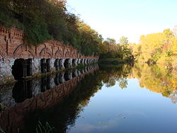
Okęcie includes three places of worship, the Church of Our Lady of Loreto at 4A Hynka Street, which belongs to the Catholic denomination, the Saint George the Victorious Church, a Polish Orthodox cathedral, located at 2 Hynka Street, and a Kingdom Hall of Jehovah’s Witnesses at 17 Krakowiaków Street.[67][70][78] The neighbourhood also features the Okęcie Cemetery, located on Leonidasa Street, which, with an area of 0.3 ha, is one of the largest burial grounds in Warsaw.[68] Furthermore, the area also features two historical retired military fortifications, dating to 1883, including Fort VI “Okęcie” at 6 Lipowczana Street, and Fort VII “Zbarż” near Bennetta Street.[9] It also includes a historic manor house built for the Schneider family in 1888, located at 11 Jedenastego Sierpnia Street.[79] Additionally, Okęcie has two small ponds, Zbarż Pond near Wirażowa Street, and Sadurka near Komitetu Obrony Robotników Street.[14][80]
- ^ a b c d e f g h Robert Gawkowski: Moja Dzielnica Włochy, historia Włoch i Okęcia. Warsaw: Włochy Town Hall, 2010, pp. 14–15. ISBN 978-83-928365-1-3. (in Polish)
- ^ a b c d e f g h “Raków”. wlochy.um.warszawa.pl (in Polish).
- ^ Robert Gawkowsk: “Skąd się wzięła nazwa ‘Okęcie'”, [in:] Okęcie – czyli lotnicze tradycje w dzielnicy Włochy. Warsaw: Włochy Town Hall, 2016, p. 6. (in Polish)
- ^ a b c “Gorzkiewki i Zbarż”. wlochy.um.warszawa.pl (in Polish).
- ^ a b c “Okęcie”. wlochy.um.warszawa.pl (in Polish).
- ^ a b Robert Gawkowski: Moja Dzielnica Włochy, historia Włoch i Okęcia. Warsaw: Włochy Town Hall, 2010, pp. 22–25. ISBN 978-83-928365-1-3. (in Polish)
- ^ Maria Nietyksza, Witold Pruss: Zmiany w układzie przestrzennym Warszawy. In: Irena Pietrza-Pawłowska (editor): Wielkomiejski rozwój Warszawy do 1918 r. Warsaw: Wydawnictwo Książka i Wiedza, p. 43. 1973. (in Polish)
- ^ a b c Robert Gawkowski: Moja Dzielnica Włochy, historia Włoch i Okęcia. Warsaw: Włochy Town Hall, 2010, p. 29. ISBN 978-83-928365-1-3. (in Polish)
- ^ a b c Lech Królikowski: Twierdza Warszawa. Warsaw: Wydawnictwo Bellona, 2002, ISBN 83-11-09356-3. (in Polish)
- ^ a b c Robert Gawkowski: Moja Dzielnica Włochy, historia Włoch i Okęcia. Warsaw: Włochy Town Hall, 2010, pp. 89–92. ISBN 978-83-928365-1-3. (in Polish)
- ^ “Historia”. rksokecie.pl (in Polish).
- ^ Marian Marek Drozdowski: Warszawa II Rzeczypospolitej, część 2. Warsaw: Instytut Historii Polskiej Akademii Nauk, 1970, p. 300. (in Polish)
- ^ Michał Głuszniewski (23 June 2020). “Strażacy zalali boisko warszawskiego klubu. ‘Pojechałem tam i się załamałem’“. przegladsportowy.onet.pl (in Polish).
- ^ a b Weseła Wojnarowicz, Paweł Gnieszawa-Słodkowski: Dzielnica Włochy. Parki, zieleńce, zabytki…. Warsaw: Włochy Municipal Office. 2012. pp. 18–19. ISBN 978-83-928365-4-4. (in Polish)
- ^ Monika Oksiuta: Przemiany sieci hydrograficznej i zagospodarowania terenu na obszarze miejskim (zlewnia Potoku Służewieckiego, Warszawa). In: Prace Geograficzne, issue 120, 2008. Kraków: Institute of Geography and Spatial Management of Jagiellonian University. ISSN 1644-3586. (in Polish).
- ^ Jerzy Gromski: “Ochota w latach 1916–1939”, [in:] Dzieje Ochoty. Warsaw: Państwowe Wydawnictwo Naukowe, 1973, p. 128. (in Polish)
- ^ Zdzisław Suwiński: Krajowa Baza Operacyjna nr 1 z Okęcia we wrześniu 1939 roku. Oświęcim: Wydawnictwo NapoleonV, 2016, p. 23. ISBN 978-83-65652-72-0. (in Polish)
- ^ a b c d e Robert Gawkowski: “Okęcka historia”, [in:] Ochotnik, no. 72/2011, pp. 8–11, Warsaw: Ośrodek Kultury Ochota. (in Polish)
- ^ Dominik Sipiński, Paweł Cybulak, Paweł Placha: Lotniska w Polsce. Łódź: Dom Wydawniczy Księży Młyn, p. 153. ISBN 978-83-7729-241-9. (in Polish)
- ^ a b c d e f g Krzysztof Komorowski (editor): Warszawa walczy 1939–1945. Leksykon. Warsaw: Fundacja Polska Walczy i Wydawnictwo Bellona, 2015, p. 552. ISBN 978-83-1113474-4. (in Polish)
- ^ Ryszard Mączewski: Warszawa między wojnami. Łódź: Księży Młyn, 2009, p. 63. ISBN 978-83-61253-51-8. (in Polish)
- ^ Grzegorz Mika: Od wielkich idei do wielkiej płyty. Burzliwe dzieje warszawskiej architektury. Warsaw: Agencja Wydawniczo-Reklamowa Skarpa Warszawska, 2017, p. 186. ISBN 978-83-63842-67-3. (in Polish)
- ^ Bernard Budzyński: “Zarys historii instrumentalnych obserwacji pogody w Warszawie”, [in:] Kronika Warszawy, no. 2 (154), p. 42, 2016. (in Polish)
- ^ Jan Bystroń: Warszawa. Warsaw: Państwowy Instytut Wydawniczy, 1977, p. 311. (in Polish)
- ^ Barbara Petrozolin-Skowrońska (editor): Encyklopedia Warszawy. Warsaw: Wydawnictwo Naukowe PWN, 1994, p. 1035. ISBN 83-01-08836-2. (in Polish)
- ^ Kamil Jabłczyński (30 April 2025). “Warszawskie okno na świat skończyło 91 lat. Tak przez lata zmieniało się lotnisko na Okęciu. Wyjątkowe zdjęcia”. warszawa.naszemiasto.pl (in Polish).
- ^ Kurier Warszawski , no. 77/1935 (morning edition), Warsaw, 19 March 1935, p. 5. (in Polish)
- ^ “Rozporządzenie Ministra Spraw Wewnętrznych z dnia 24 marca 1939 r. o utworzeniu gminy wiejskiej Okęcie w powiecie i województwie warszawskim”. isap.sejm.gov.pl (in Polish).
- ^ a b “Warszawa Okęcie”. atlaskolejowy.net (in Polish).
- ^ a b “Warszawa Aleje Jerozolimskie – Warszawa Okęcie”. atlaskolejowy.net (in Polish).
- ^ “8b Wyczółki – Paluch”. atlaskolejowy.net (in Polish).
- ^ “Paluch”. atlaskolejowy.net (in Polish).
- ^ a b c d e f g Józef Kazimierz Wroniszewski: Ochota 1939–1945. Warszawa: Wydawnictwo MON, 1976, p. 113–124. (in Polish)
- ^ a b c d Dariusz Kaliński: Twierdza Warszawa. Pierwsza wielka bitwa miejska II wojny światowej. Kraków: Znak Horyzont, 2022, p. 308–318. ISBN 978-83-240-8785-3. (in Polish)
- ^ a b c Ludwik Głowacki: Obrona Warszawy i Modlina na tle kampanii wrześniowej 1939. Warsaw: Wydawnictwo Ministerstwa Obrony Narodowej, 1985, p. 156. ISBN 83-11-07109-8. (in Polish)
- ^ Tomasz Szarota: Okupowanej Warszawy dzień powszedni. Warszawa: Czytelnik, 2010, p. 21. ISBN 978-83-07-03239-9. (in Polish)
- ^ Piotr Rozwadowski (editor): Wielka Ilustrowana Encyklopedia Powstania Warszawskiego. Tom 1. Warsaw: Dom Wydawniczy Bellona, 2005, p. 424. ISBN 83-11-09261-3. (in Polish)
- ^ Gemeinde- und Dorfverzeichnis für das Generalgouvernement. Warsaw: General Government, 1943. (in German)
- ^ H. Szołdrska: Lotnictwo Podziemia czyli Dzieje Wydziału Lotniczego KG AK. Warsaw: Wydawnictwa Komunikacji i Łączności, 1986, p. 109. ISBN 978-83-206-0532-7. (in Polish)
- ^ J. Kulesza: Garłuch: opowieść o siódmym pułku piechoty Armii Krajowej 1939–1944. Vipart, 2004, pp. 139–140. ISBN 978-83-87124-47-2. (in Polish)
- ^ J. W. Solecki: “Sen o spadochronach“, Zeszyty Historyczne, p. 131, [in:] Biblioteka ‘Kultury, vol. 510. Paris: Literary Institute, p. 99–101. (in Polish)
- ^ Jakub Jastrzębski. “Wysoka przeszłość Okęcia”, [in:] Skarpa Warszawska, p. 17. Warsaw, July 2021. (in Polish)
- ^ Bronisław Dostatni: “Ochota ośrodkiem komunikacji lotniczej”, [in:] Dzieje Ochoty. Warsaw: Państwowe Wydawnictwo Naukowe, 1973, pp. 188–189. (in Polish)
- ^ Karol Mórawski: Warszawskie cmentarze. Przewodnik historyczny. Warsaw: PTTK Kraj, 1991, pp. 63-64. ISBN 83-7005-333-5. (in Polish)
- ^ “Rozporządzenie Rady Ministrów z dnia 5 maja 1951 r. w sprawie zmiany granic miasta stołecznego Warszawy”. isap.sejm.gov.pl (in Polish).
- ^ Andrzej Gawryszewski: Ludność Warszawy w XX wieku. Warsaw: Instytut Geografii i Przestrzennego Zagospodarowania PAN, 2009, pp. 44–50. ISBN 978-83-61590-96-5. (in Polish)
- ^ a b Barbara Petrozolin-Skowrońska (editor): Encyklopedia Warszawy. Warsaw: Wydawnictwo Naukowe PWN, 1994, p. 568, ISBN 83-01-08836-2.
- ^ Robert Gawkowski: Moja Dzielnica Włochy, historia Włoch i Okęcia. Warsaw: Włochy Town Hall, 2010, p. 207. ISBN 978-83-928365-1-3. (in Polish)
- ^ Jarosław Zieliński: Realizm socjalistyczny w Warszawie. Urbanistyka i architektura (1949–1956). Warsaw: Fundacja Hereditas, 2009, p. 362–363, ISBN 978-83-927791-3-1. (in Polish)
- ^ Tadeusz Komorowski: “Nowe osiedle mieszkaniowe Okęcie II“, Stolica, no. 20 (282), Warsaw, 17 May 1953, p. 7, ISSN 0039-1689. (in Polish)
- ^ Barbara Petrozolin-Skowrońska (editor): Encyklopedia Warszawy. Warsaw: Wydawnictwo Naukowe PWN, 1994. ISBN 83-01-08836-2.
- ^ a b Lech Chmielewski: Przewodnik warszawski. Gawęda o nowej Warszawie. Warsaw: Agencja Omnipress, Państwowe Przedsiębiorstwo Wydawnicze Rzeczpospolita. ISBN 8385028560. (in Polish)
- ^ Andrzej Rottermund, Juliusz Chrościcki: Atlas architektury Warszawy. Warsaw: Arkady. ISBN 8301088362. (in Polish)
- ^ a b “Park im. Marka Kotańskiego”. wlochy.um.warszawa.pl (in Polish).
- ^ a b Weseła Wojnarowicz, Paweł Gnieszawa-Słodkowski: Dzielnica Włochy. Parki, zieleńce, zabytki…. Warsaw: Włochy Municipal Office. 2012. p. 8. ISBN 978-83-928365-4-4. (in Polish)
- ^ a b Barbara Petrozolin-Skowrońska (editor): Encyklopedia Warszawy. Warsaw: Państwowe Wydawnictwo Naukowe, 1975, p. 84. (in Polish)
- ^ a b c Cite error: The named reference
krzyzwas invoked but never defined (see the help page). - ^ “Nasza historia”. lotnisko-chopina.pl (in Polish).
- ^ “Po tragicznej katastrofie “Viscounta” na Okęciu: Ustalono już listę ofiar katastrofy” [After the tragic crash of “Viscount” at Okęcie: The list of victims of the disaster has already been established]. Dziennik Bałtycki (in Polish). XVIII (302). Gdańsk. 21 December 1962. Retrieved 9 May 2013.
- ^ “45 rocznica katastrofy Ił-a 62 ‘Mikołaj Kopernik’“. dlapilota.pl (in Polish). 14 March 2025.
- ^ Tomasz Smolicz: Lima, Oskar…. Kraków–Wrocław: Wydawnictwo Literackie, 1985, pp. 132–138. ISBN 83-08-01407-0. (in Polish)
- ^ Dariusz Burliński: Katastrofy lotnicze. Tajemnice wypadków polskich samolotów. Warsaw: Ringier Axel Springer, 2014, pp. 42–55. ISBN 978-83-7813-624-8. (in Polish)
- ^ a b “Warszawa Służewiec”. atlaskolejowy.net (in Polish).
- ^ a b “Warszawa Rakowiec (po)”. atlaskolejowy.net (in Polish).
- ^ a b “Warszawa Żwirki i Wigury”. atlaskolejowy.net (in Polish).
- ^ a b “Z aktualności ZTM: Pociągi połączyły lotnisko z centrum”. ztm.waw.pl (in Polish). 30 May 2012.
- ^ a b Warszawa. Św. Franciszka z Asyżu (in Polish) https://archwwa.pl/parafie/warszawa-sw-franciszka-z-asyzu/.
- ^ a b “Parafia św. Franciszka z Asyżu na Okęciu”. wlochyinfo.org. 17 January 2024.
- ^ a b Aleksandra Stępień-Dąbrowska: Jakby luksusowo. Przewodnik po architekturze Warszawy lat 90. Warsaw: Narodowy Instytut Architektury i Urbanistyki, 2021, pp. 8–9, 76–77. ISBN 978-83-960286-8-6. (in Polish)
- ^ a b Łukasz Godun (2 May 2018). “Otwarcie i poświęcenie nowej siedziby Ordynariatu”. orthodox.pl (in Polish).
- ^ “Lotnisko i jego historia”. wlochy.um.warszawa.pl (in Polish).
- ^ “Lotnisko Chopina – w 2023 roku prawie 18,5 miliona pasażerów”. turystyka.rp.pl (in Polish).
- ^ “LOT Polish Airlines”. staralliance.com.
- ^ “LOT Polish Airlines Eyes Up-Gauge to 737 MAX and A320neo and Touts 787 Improvement”. Airchive. Archived from the original on 5 April 2015. Retrieved 24 April 2015.
- ^ “Our activities”. fly.enterair.pl.
- ^ “Wizz Air predicts record 4.8 million passengers from Warsaw in 2024”. polskieradio.pl. 16 October 2024.
- ^ Cite error: The named reference
dostatniwas invoked but never defined (see the help page). - ^ “Meeting search”. apps.jw.org (in Polish).
- ^ Weseła Wojnarowicz, Paweł Gnieszawa-Słodkowski: Dzielnica Włochy. Parki, zieleńce, zabytki…. Warsaw: Włochy Municipal Office. 2012. p. 31. ISBN 978-83-928365-4-4. (in Polish)
- ^ : ZAŁĄCZNIK TEKSTOWY I TABELARYCZNY DO PROGRAMU OCHRONY ŚRODOWISKA DLA MIASTA STOŁECZNEGO WARSZAWY na lata 2009–2012 z uwzględnieniem perspektywy do 2016 r. Warsaw: Warsaw City Council, 21 October 2010. (in Polish)

