
Content deleted Content added
|
|
|||
| Line 64: | Line 64: | ||
|
== Public Water Access == |
== Public Water Access == |
||
|
A ramp for public water access is located on County Road 13, east of Highway 371.<ref>{{Cite web |last=background |first=Pineandlakes Echo Journal Comments Share Share this article Explainer Explainer Provides context or |last2=definition |last3=this? |first3=detail on a specific topic The Trust Project What is |date=2025-05-19 |title=Clark Lake contour map – Crow Wing County |url=https://www.pineandlakes.com/sports/northland-outdoors/clark-lake-contour-map-crow-wing-county |access-date=2025-12-19 |website=Pine & Lakes Echo Journal |language=en}}</ref> |
A ramp for public water access is located on County Road 13, east of Highway 371.<ref>{{Cite web |last=background |first=Pineandlakes Echo Journal Comments Share Share this article Explainer Explainer Provides context or |last2=definition |last3=this? |first3=detail on a specific topic The Trust Project What is |date=2025-05-19 |title=Clark Lake contour map – Crow Wing County |url=https://www.pineandlakes.com/sports/northland-outdoors/clark-lake-contour-map-crow-wing-county |access-date=2025-12-19 |website=Pine & Lakes Echo Journal |language=en}}</ref> |
||
|
{{Weather box |
|||
|
| location = Bloomington, Minnesota |
|||
|
| single line = Y |
|||
|
| Jan high F = 22 |
|||
|
| Feb high F = 29 |
|||
|
| Mar high F = 41 |
|||
|
| Apr high F = 57 |
|||
|
| May high F = 70 |
|||
|
| Jun high F = 79 |
|||
|
| Jul high F = 83 |
|||
|
| Aug high F = 80 |
|||
|
| Sep high F = 71 |
|||
|
| Oct high F = 58 |
|||
|
| Nov high F = 40 |
|||
|
| Dec high F = 26 |
|||
|
| Jan low F = 4 |
|||
|
| Feb low F = 12 |
|||
|
| Mar low F = 23 |
|||
|
| Apr low F = 36 |
|||
|
| May low F = 48 |
|||
|
| Jun low F = 58 |
|||
|
| Jul low F = 63 |
|||
|
| Aug low F = 61 |
|||
|
| Sep low F = 51 |
|||
|
| Oct low F = 39 |
|||
|
| Nov low F = 25 |
|||
|
| Dec low F = 11 |
|||
|
| Jan precipitation inch = 1.04 |
|||
|
| Feb precipitation inch = 0.79 |
|||
|
| Mar precipitation inch = 1.86 |
|||
|
| Apr precipitation inch = 2.31 |
|||
|
| May precipitation inch = 3.24 |
|||
|
| Jun precipitation inch = 4.34 |
|||
|
| Jul precipitation inch = 4.04 |
|||
|
| Aug precipitation inch = 4.05 |
|||
|
| Sep precipitation inch = 2.69 |
|||
|
| Oct precipitation inch = 2.11 |
|||
|
| Nov precipitation inch = 1.94 |
|||
|
| Dec precipitation inch = 1.00 |
|||
|
| source 1 = weather.com<ref name=weatherbox >{{cite web |
|||
|
| url = http://www.weather.com/weather/wxclimatology/monthly/USMN0840 |title=Average weather for Bloomington, Minnesota USA |access-date=January 12, 2009 |
|||
|
| date = June 2011}}</ref> |
|||
|
| date = August 2010 |
|||
|
| source = |
|||
|
| width = 100% |
|||
|
}} |
|||
|
==References== |
==References== |
||
|
{{Reflist}} |
{{Reflist}} |
||
Latest revision as of 20:47, 19 December 2025
Clark Lake has a maximum depth of 31(ft) and a surface area of about 305 acres.[1], and a shoreline length of approximately 5 miles.[2]
Physical characteristics
[edit]
Basic Lake Characterisitics
[edit]
Hydrologic setting and water balance
[edit]
Groundwater interaction
[edit]
Water‑level behavior
[edit]
Watershed and regional context
[edit]
Ecological Features
[edit]
Environmental History
[edit]
Fish species in the Clark Lake include black bullhead, black crappie, bluegill, brown bullhead, green sunfish, hybrid sunfish, largemouth bass, northern pike, pumpkinseed, smallmouth bass, walleye, yellow bullhead, yellow perch, bowfin (dogfish), common carp, white sucker, banded killifish, blacknose shiner, bluntnose minnow, emerald shiner, and golden shiner.[3][4]

The history of Clark lake isn’t just about the lake itself but the greater community of Nisswa and Crow Wing County Minnesota.
Fishing Opportunities
[edit]
Water Sports and Boating
[edit]
Nearby Trails and Parks
[edit]
.jpg)
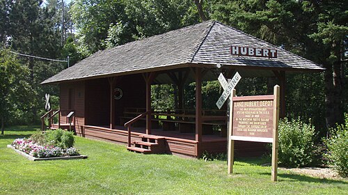
Recreation on Clark Lake consists of Paul Bunyan trail.
Conservation and management
[edit]
Watershed Strategies
[edit]
Public Water Access
[edit]
A ramp for public water access is located on County Road 13, east of Highway 371.[5]
| Climate data for Bloomington, Minnesota | |||||||||||||
|---|---|---|---|---|---|---|---|---|---|---|---|---|---|
| Month | Jan | Feb | Mar | Apr | May | Jun | Jul | Aug | Sep | Oct | Nov | Dec | Year |
| Mean daily maximum °F (°C) | 22 (−6) |
29 (−2) |
41 (5) |
57 (14) |
70 (21) |
79 (26) |
83 (28) |
80 (27) |
71 (22) |
58 (14) |
40 (4) |
26 (−3) |
55 (13) |
| Mean daily minimum °F (°C) | 4 (−16) |
12 (−11) |
23 (−5) |
36 (2) |
48 (9) |
58 (14) |
63 (17) |
61 (16) |
51 (11) |
39 (4) |
25 (−4) |
11 (−12) |
36 (2) |
| Average precipitation inches (mm) | 1.04 (26) |
0.79 (20) |
1.86 (47) |
2.31 (59) |
3.24 (82) |
4.34 (110) |
4.04 (103) |
4.05 (103) |
2.69 (68) |
2.11 (54) |
1.94 (49) |
1.00 (25) |
29.41 (746) |
| Source: weather.com[6] | |||||||||||||

