


Content deleted Content added
|
|
|||
| Line 7: | Line 7: | ||
|
| foundation = 1977 |
| foundation = 1977 |
||
|
| founded_by = |
| founded_by = |
||
|
| country = |
| country = |
||
|
| district = js |
| district = js |
||
|
| council = [[Mateh Binyamin Regional Council|Mateh Binyamin]] |
| council = [[Mateh Binyamin Regional Council|Mateh Binyamin]] |
||
Latest revision as of 09:38, 30 January 2026
Israeli settlement in the West Bank
Place in Judea and Samaria Area, Palestine
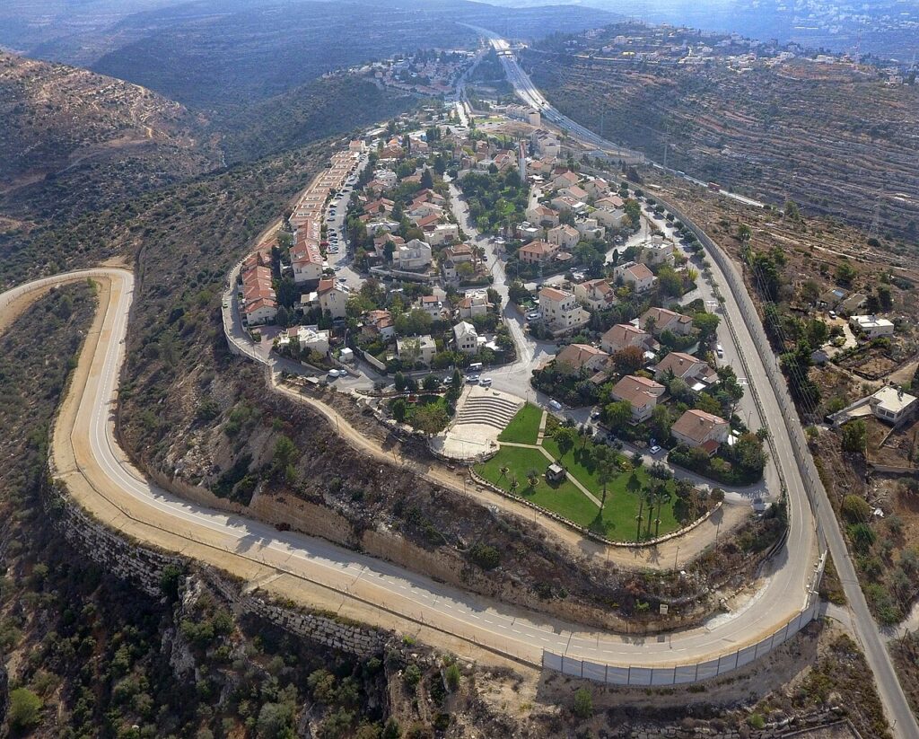
Beit Horon (Hebrew: בית חורון) is a communal Israeli settlement in the West Bank. Bordering Route 443 between Modi’in and Jerusalem, the biblical pass of Beit Horon (Joshua 10:10), after which it is named,[2] it falls under the jurisdiction of Mateh Binyamin Regional Council. In 2023 it had a population of 1,496.
The international community considers Israeli settlements in the West Bank illegal under international law, but the Israeli government disputes this.[3]
History
Beit Horon was established on 1 December 1977.[4]
According to ARIJ, Israel confiscated land from several surrounding Palestinian villages in order to construct Beit Horon:
Beit Horon is a joint Secular and Orthodox community.[9]
A religious elementary school located in Beit Horon serves local children as well as those from surrounding villages. There are also three nurseries and kindergarten, two synagogues, a kollel, a mikvah for women and men, and a library.[10]
See also
References
- ^ “Regional Statistics”. Israel Central Bureau of Statistics. Retrieved 11 August 2025.
- ^ Carta’s Official Guide to Israel and Complete Gazetteer to all Sites in the Holy Land. (3rd edition 1993) Jerusalem, Carta, p.112, ISBN 965-220-186-3 (English)
Bitan, Hanna: 1948-1998: Fifty Years of ‘Hityashvut’: Atlas of Names of Settlements in Israel, Jerusalem 1999, Carta, p.10, ISBN 965-220-423-4 (Hebrew) - ^ “The Geneva Convention”. BBC News. 10 December 2009. Retrieved 27 November 2010.
- ^ “Israelis, Palestinians Share Fears As Talks Likely Delayed”. Orlando Sentinel. July 23, 1995. Retrieved August 22, 2012.
- ^ Beituniya Town Profile, ARIJ, pp. 17-18
- ^ Beit ‘Ur al Fauqa Village Profile, ARIJ, p. 16
- ^ At Tira Village Profile, ARIJ, p. 16
- ^ Kharbatha al Misbah Village Profile, ARIJ, p. 16
- ^ “BEIT HORON.” תנועת ההתיישבות אמנה, בית חורון, http://www.amana.co.il/?CategoryID=100&ArticleID=169.
- ^ Beit Horon Archived July 27, 2011, at the Wayback Machine Amana


