
Content deleted Content added
|
|
|||
| Line 4: | Line 4: | ||
|
| official_name = Taylak district |
| official_name = Taylak district |
||
|
| native_name = |
| native_name = |
||
|
| image_skyline = |
| image_skyline = |
||
|
| imagesize = |
| imagesize = |
||
|
| image_caption = |
| image_caption = |
||
| Line 49: | Line 49: | ||
|
| footnotes = |
| footnotes = |
||
|
}} |
}} |
||
|
”’Toyloq |
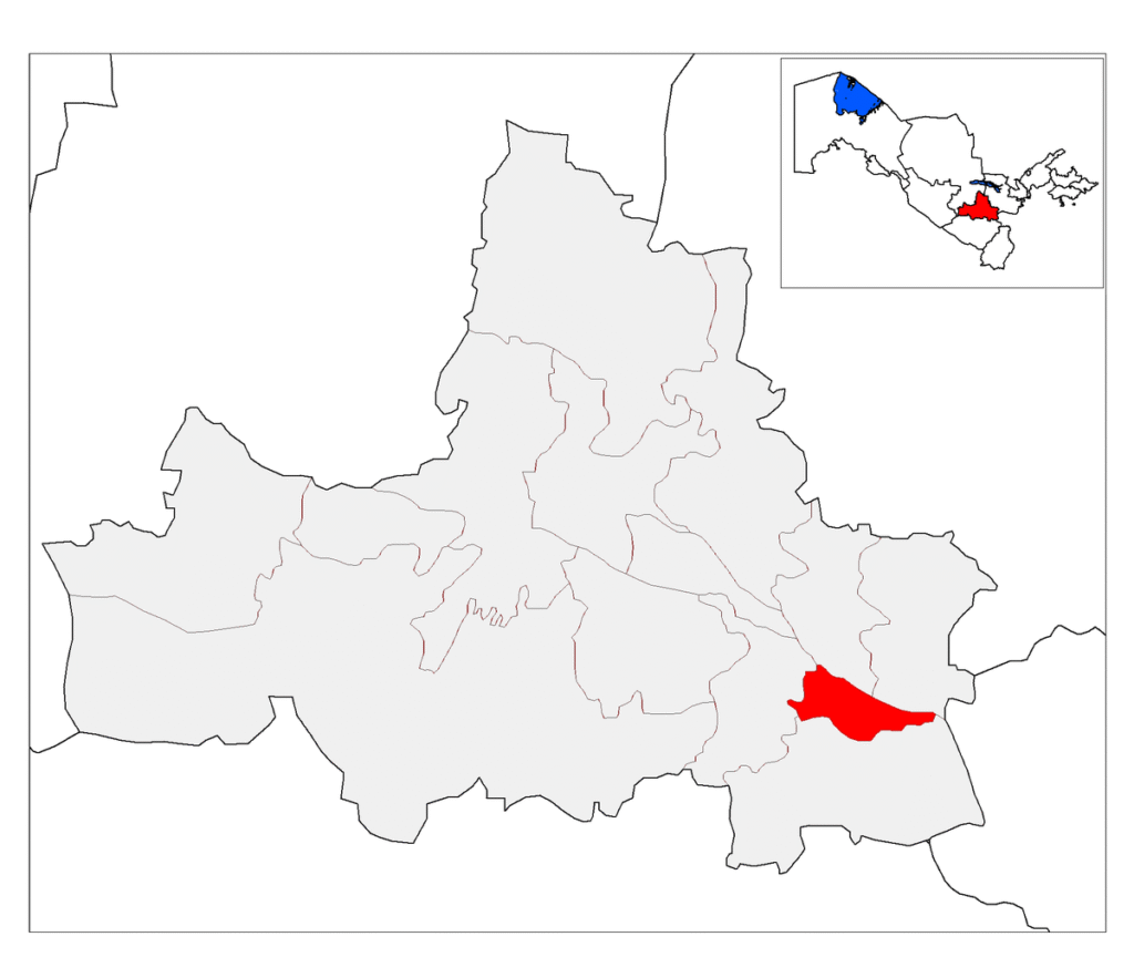
”’Toyloq ”’ is a [[Districts of Uzbekistan|district]] of [[Samarqand Region]] in [[Uzbekistan]]. The capital lies at the town [[Toyloq]].<ref name=class>{{cite web|url=https://stat.uz/uploads/docs/soato(mhobt)_2020.xlsx|title=Classification system of territorial units of the Republic of Uzbekistan|language=uz, ru|date=July 2020|publisher=The State Committee of the Republic of Uzbekistan on statistics}}</ref> It has an area of {{cvt|280|km2}}<ref>{{cite web|url=https://samstat.uz/uz/rasmiy-statistika/demography-2|title=Samarqand viloyatining ma’muriy-hududiy bo’linishi|trans-title=Administrative-territorial division of the Samarqand Region|publisher=Samarqand regional department of statistics|lang=uz|type=PDF}}</ref> and its population is 211,600 (2022 est.).<ref name=samstat>{{cite web|url=https://samstat.uz/files/284/Demografiya/1705/Hududlar-boyicha-shahar-va-qishloq-aholisi-soni.pdf|title=Urban and rural population by district|publisher=Samarkand regional department of statistics|lang=uz}}</ref> |
||
|
The district consists of 3 [[urban-type settlement]]s ([[Toyloq]], Adas, Bogʻizagʻon) and 9 rural communities.<ref name=class/> |
The district consists of 3 [[urban-type settlement]]s ([[Toyloq]], Adas, Bogʻizagʻon) and 9 rural communities.<ref name=class/> |
||
Latest revision as of 06:49, 15 November 2025
District in Samarqand Region, Uzbekistan
Toyloq tumani is a district of Samarqand Region in Uzbekistan. The capital lies at the town Toyloq.[1] It has an area of 280 km2 (110 sq mi)[2] and its population is 211,600 (2022 est.).[3]
The district consists of 3 urban-type settlements (Toyloq, Adas, Bogʻizagʻon) and 9 rural communities.[1]

