
Updated and added geographical references, added locality
| ← Previous revision | Revision as of 03:40, 22 September 2025 | ||
| Line 1: | Line 1: | ||
|
{{Infobox settlement
|
{{Infobox settlement
|
||
|
|official_name = Darbyville
|
|official_name = Darbyville
|
||
|
|settlement_type = locality<ref name=”CGNDB”>{{cite cgndb|id= FAVIM|name= Darbyville|access-date= 2025-09-21}}</ref>
|
|||
|
|settlement_type = Unincorporated community
|
|||
|
|nickname = Darb’s
|
|nickname = Darb’s
|
||
|
|motto =
|
|motto =
|
||
| Line 15: | Line 15: | ||
|
|pushpin_map = CAN ON Halton#Canada Southern Ontario
|
|pushpin_map = CAN ON Halton#Canada Southern Ontario
|
||
|
|pushpin_map_caption = Location of Darbyville
|
|pushpin_map_caption = Location of Darbyville
|
||
|
|coordinates = {{coord|43|32|42|N|80|03|52|W|region:CA-ON|display=inline,title}}<ref name=gaz1952>{{cite book|title=Gazetteer of Canada: Southwestern Ontario|url=https://books.google.com/books?id=za1RAQAAMAAJ|year=1952|publisher=authority of the Canadian Board on Geographical Names|page=56}}</ref>
|
|coordinates = {{coord|43|32|42|N|80|03|52|W|region:CA-ON|display=inline,title}}
|
||
|
<ref name=gaz1952>{{cite book|title=Gazetteer of Canada: Southwestern Ontario|url=https://books.google.com/books?id=za1RAQAAMAAJ|year=1952|publisher=authority of the Canadian Board on Geographical Names|page=56}}</ref>
|
|||
|
|pushpin_mapsize =
|
|pushpin_mapsize =
|
||
| Line 69: | Line 70: | ||
|
|area_code =
|
|area_code =
|
||
|
|blank1_name = [[Geographical Names Board of Canada|GNBC]] Code
|
|blank1_name = [[Geographical Names Board of Canada|GNBC]] Code
|
||
|
|blank1_info = FAVIM<ref name=”CGNDB” />
|
|||
|
|blank1_info = FAVIM<ref name=”GNBC”>{{cite web | title = Darbyville | publisher = Natural Resources Canada | date = October 6, 2016 | url = http://www4.rncan.gc.ca/search-place-names/unique/FAVIM}}</ref>
|
|||
|
|website =
|
|website =
|
||
|
|footnotes =
|
|footnotes =
|
||
|
}}
|
}}
|
||
|
”’Darbyville”’ is a small
|
”’Darbyville”’ is a small in [[Milton, Ontario]], Canada.<ref name=””/> The settlement was originally located in [[Nassagaweya Township, Ontario|Nassagaweya Township]], Halton County.<ref name=gaz1952 />
|
||
|
==Geography==
|
==Geography==
|
||
|
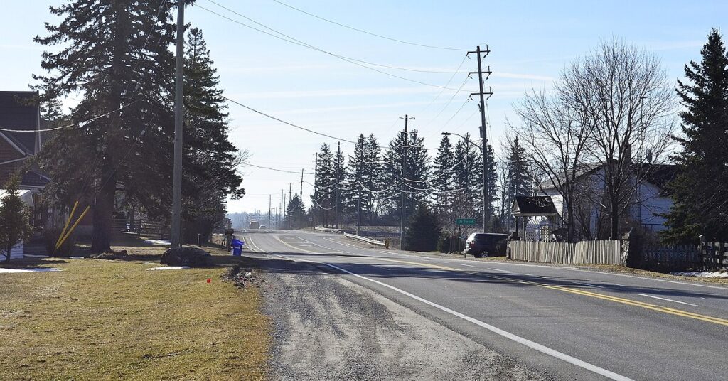
Darbyville is located along the Guelph Line (Regional Road 1), at the intersection with 20 Side Road (Regional Road 34). Mountsberg Creek flows through Darbyville. It is surrounded by farmland and there is a golf course nearby.
|
Darbyville is located along the Guelph Line (Regional Road 1), at the intersection with 20 Side Road (Regional Road 34). Mountsberg Creek flows through Darbyville. It is surrounded by farmland and there is a golf course nearby.
|
||
|
==History==
|
==History==
|
||

