
*[[Kole District|Kole]]
*[[Kole District|Kole]]
*[[Lira District|Lira]]
*[[Lira District|Lira]]
*[[Lira, Uganda|Lira city]]<ref>{{Cite web |title=About {{!}} Lira City |url=https://www.liracity.go.ug/about-lira |access-date=2025-12-18 |website=www.liracity.go.ug}}</ref>
*[[Oyam District|Oyam]]
*[[Oyam District|Oyam]]
*[[Otuke District|Otuke]]
*[[Otuke District|Otuke]]
Sub-region in Northern Region, Uganda
|
Lango sub-region |
|
|---|---|

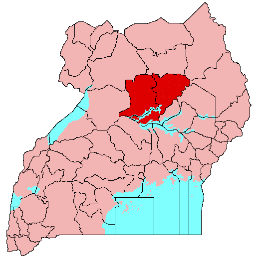
Interactive map of Lango sub-region |
|
| Country | Uganda |
| Region | Northern Region |
| Largest urban centre | Lira City |
|
• Total |
12,856[1] km2 (4,964 sq mi) |
|
• Total |
2,567,518[2] |
| Time zone | UTC+3 (EAT) |


Lango sub-region is a region in Uganda covering an area of 15,570.7km consisting of the districts of:
It covers the area previously known as Lango District until 1974, when it was split into the districts of Apac and Lira, and subsequently into several other districts. The sub-region is home mainly to the Lango ethnic group. Lango sub-region is home to Dr. Apollo Milton Obote, a former president that led Uganda to independence in 1962, whose ancestral home and monument acts as a national heritage site managed by Uganda Tourism Board.[4]
At the 2002 national census, it had a population of about 1.5 million people. As of July 2018, its population was an estimated 2.3 million, about 5.75% of the estimated 40 million Ugandans at the time.[5]
Leadership
Lango sub-region is headed by a paramount chief, also known as “Won Nyaci” and is elected by a council of elders from different clans in Lango. The newly elected chief is Odongo Okune who took office after the death of Yosam Odur Ibii, former Lango chief.[6][7]
Geography
Lango lies in north-central Uganda, about 230 km by road north of Kampala.[8] The area includes wetlands and lakes associated with the Lake Kyoga basin, including Lake Kwania in parts of Dokolo District.
Administrative divisions
Uganda Investment Authority describes Lango as comprising nine districts: Alebtong, Amolatar, Apac, Dokolo, Kole, Kwania, Lira, Otuke, Oyam.[8]
Demographics
The Uganda Bureau of Statistics reported a 2014 to 2024 average annual growth rate of 2.3% for Lango sub-region.[9]
Economy
Lango’s economy is strongly linked to crop farming and livestock production, within annual cropping and cattle-farming systems common across Northern Uganda.[8] Trade and services play a major role in urban centres such as Lira and Apac.[8]
Language
The main local language is Lango, also known as Leb Lango, a Western Nilotic language with ISO 639-3 code “laj”.[10][11]
Infrastructure
Central government has cited upgrades to key roads in Lango, including the Kamdini to Lira corridor, as part of wider infrastructure work in Northern Uganda.[12]
See also
References
- ^ “Lango (Subregion, Uganda)”. City Population. Retrieved 2025-12-17.
- ^ “National Population and Housing Census 2024, Preliminary Report” (PDF). Uganda Bureau of Statistics. 2024. p. 11. Retrieved 2025-12-17.
- ^ “About | Lira City”. www.liracity.go.ug. Retrieved 2025-12-18.
- ^ Reporter, Vision. “Lango region embraces tourism”. New Vision. Retrieved 2025-12-13.
- ^ Namagembe, Lillian (31 July 2018). “US Donates Shs125 Billion to Uganda”. Daily Monitor. Kampala. Retrieved 31 July 2018.
- ^ Reporter, NewVision (2024-03-02). “People: Odongo elected new Lango Paramount Chief”. New Vision. Retrieved 2025-12-13.
- ^ Okino, Patrick (2025-11-10). “Celebrating Life: Lango paramount chief Yosam Odur Ebii dies”. New Vision. Retrieved 2025-12-13.
- ^ a b c d “Lango Profile” (PDF). Uganda Investment Authority. 2019. Retrieved 2025-12-17.
- ^ “National Population and Housing Census 2024, Preliminary Report” (PDF). Uganda Bureau of Statistics. 2024. p. 10. Retrieved 2025-12-17.
- ^ “Lango language (Uganda)”. Wikipedia. Retrieved 2025-12-17.
- ^ “Glottolog, Lango (Uganda)”. Glottolog. Retrieved 2025-12-17.
- ^ “Government is committed to work on Lango sub-region roads, says PM Nabbanja”. Office of the Prime Minister, Uganda. 2022-01-21. Retrieved 2025-12-17.

